


Moderate Trails
Nature Trails
For details and directions click on any trail image.
-
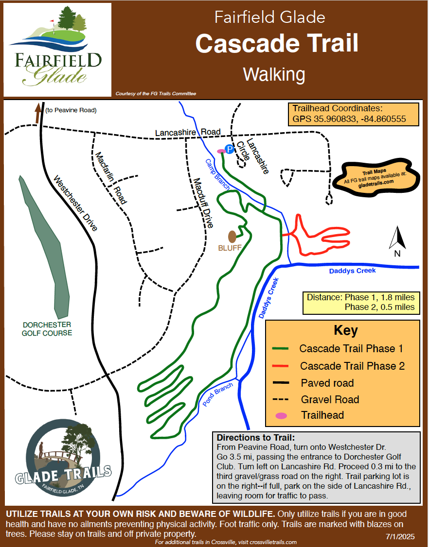
Distance: 1.8
-
Trailhead GPS Coordinates: 35.960833, -84.860555
Opened in 2025, the main trail is 1.8 miles long, boasting great views, beautiful rock features, huge old trees, shade, and water everywhere. After a rainfall, the cascading waterfalls come alive, creating one of the Fairfield Glade's most picturesque hikes.

-
Distance: 4.2
-
Trailhead GPS Coordinates: 36.031447, -84.850316
McGinnis is commonly referred to as the Green Trail noted because you will follow the green or octagon markers. The trail takes in sections of the Good Samaritan Trail (yellow markers) and the Rotherham Trail (red markers). While mostly wooded there is a short section on a paved sidewalk.


-
Distance: 3.0
-
Trailhead GPS Coordinates: 36.024444, -84.868611
Rotherham is commonly referred to as the Red Trail due to its red markers. By following the red trail markers, you will hike the Hemlock, a part of McGinnis and a part of Good Samaritan. While mostly wooded you will have a short section of paved sidewalk. You will have views of Lake Dartmoor where you can take a relaxing break. There is a lot to experience hiking the Rotherham Trail.


-
Distance: 2.9
-
Trailhead GPS Coordinates: 36.031389, -84.850000
The Good Samaritan Trail is named for the nearby Good Samaritan facility, now known as the Preserve. To many locals it is also referred to as the Yellow Trail for its yellow trail markers. While this trail is on paved walkways and some roadway at the peak of the mountain, the large rock features and views are worth the short hike.
-
Distance: 1.9
-
Trailhead GPS Coordinates: 35.967933, -84.850431
A favorite among Fairfield Glade hikers, the Overlook Trail is managed by Cumberland Mountain State Park. Choose the 1.7-mile North Loop, the 0.9-mile South Loop, or combine both for a longer hike featuring scenic overlooks and peaceful views of Daddy's Creek that attracks a variety of wildlife.


-
Distance: 2.0 miles
-
Trailhead GPS Coordinates: 35.998370, -84.870564
This trail begins at the Methodist Church on Westchester Drive. It is a pleasant walk through the woods by a number of streams crossed by seven bridges. The trail is a lollipop configuration consisting of a half-mile stem and then a one-mile loop…return to the trailhead along the stem. You can extend your hike by including the 0.5 mile St. George Trail loop. The short connector between the two trails is approximately halfway around the loop.


-
Distance: 3.0 miles
-
Trailhead GPS Coordinates: 36.018751, -84.885131
This trail in an out and back trail. The half-way point is the Heatherhurst golf club. The highest point of the trail is around the Lynhurst Drive area. Consequently it is a steady, but manageable, uphill climb from either end of the trail. This well traveled trail is popular with residents.

