top of page


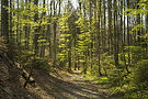
Difficult Trails
Nature Trails
For details and directions click on any trail image.
-
Distance: 6.1
-
Trailhead GPS Coordinates: 36.017500, -84.863055
The Blue Loop trail is named due to its blue trail markers. It is the only trail, to date, rated difficult as it is the longest trail in Fairfield Glade.
It boarders the Good Samaritan, Rotherham and McGinnis trails.
The lowest point is at the end of Lake Dartmoor on Rotherham Drive. The highest point is at the top of the Rotherham Trail near the water tower. In addition there are two challenging climbs on the McGinnis Trail.
It is a popular hike for the Spring Ultra hike that is 100 miles of trail to challenge the most advid hikers.


bottom of page